Portfolio
I have worked on various projects involving spatial analysis, raster analysis, GIS development and more, both academically and professionally.
All
Academic
Projects
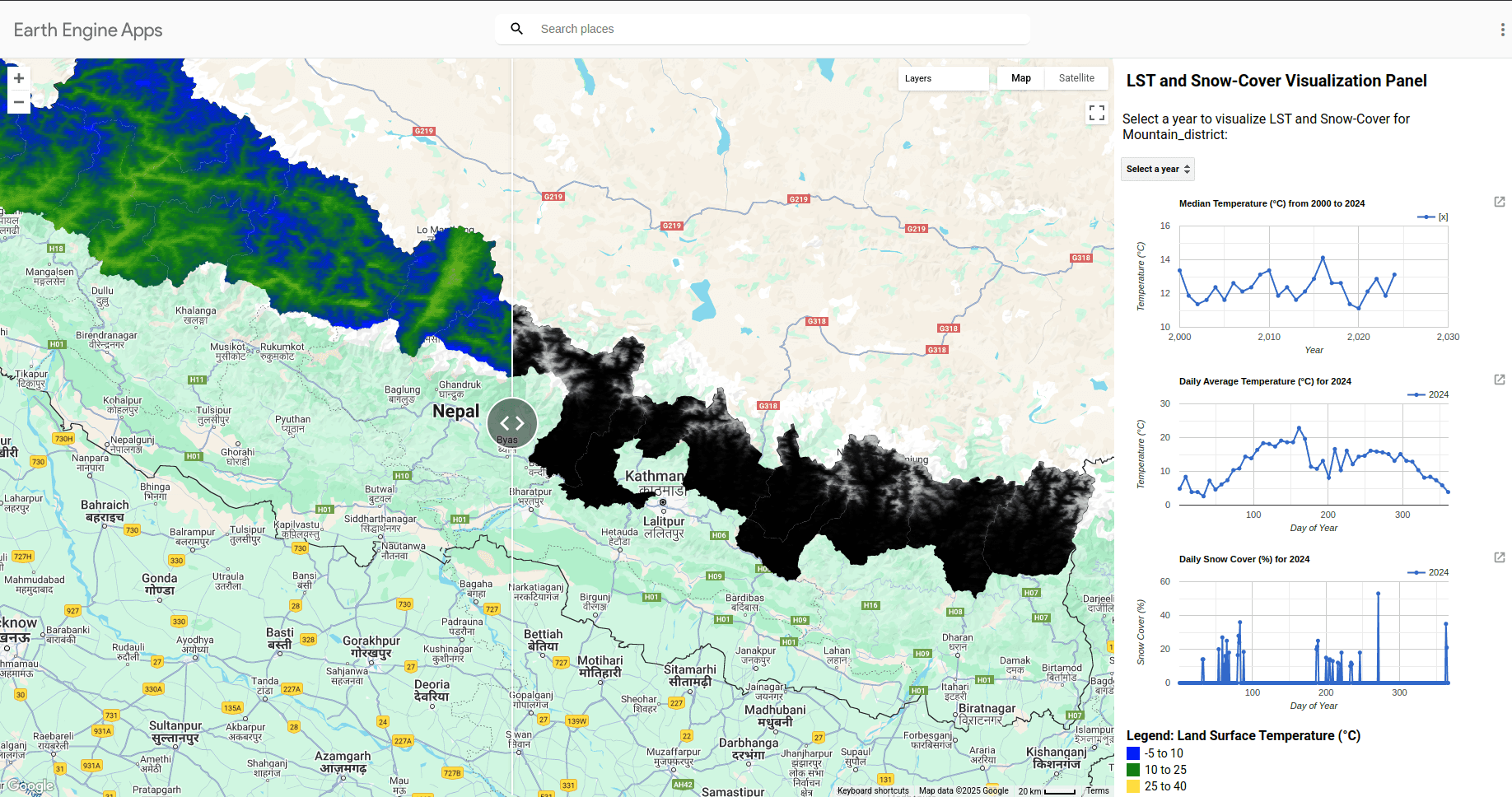
Remote sensing with GEE
Descriptive statistic and data classification
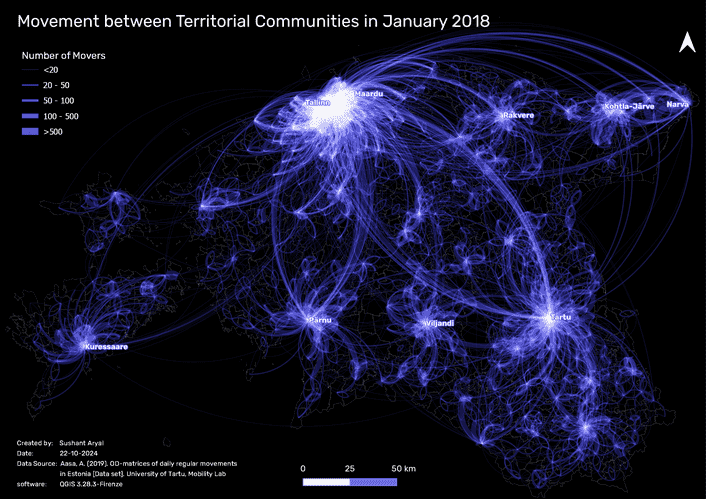
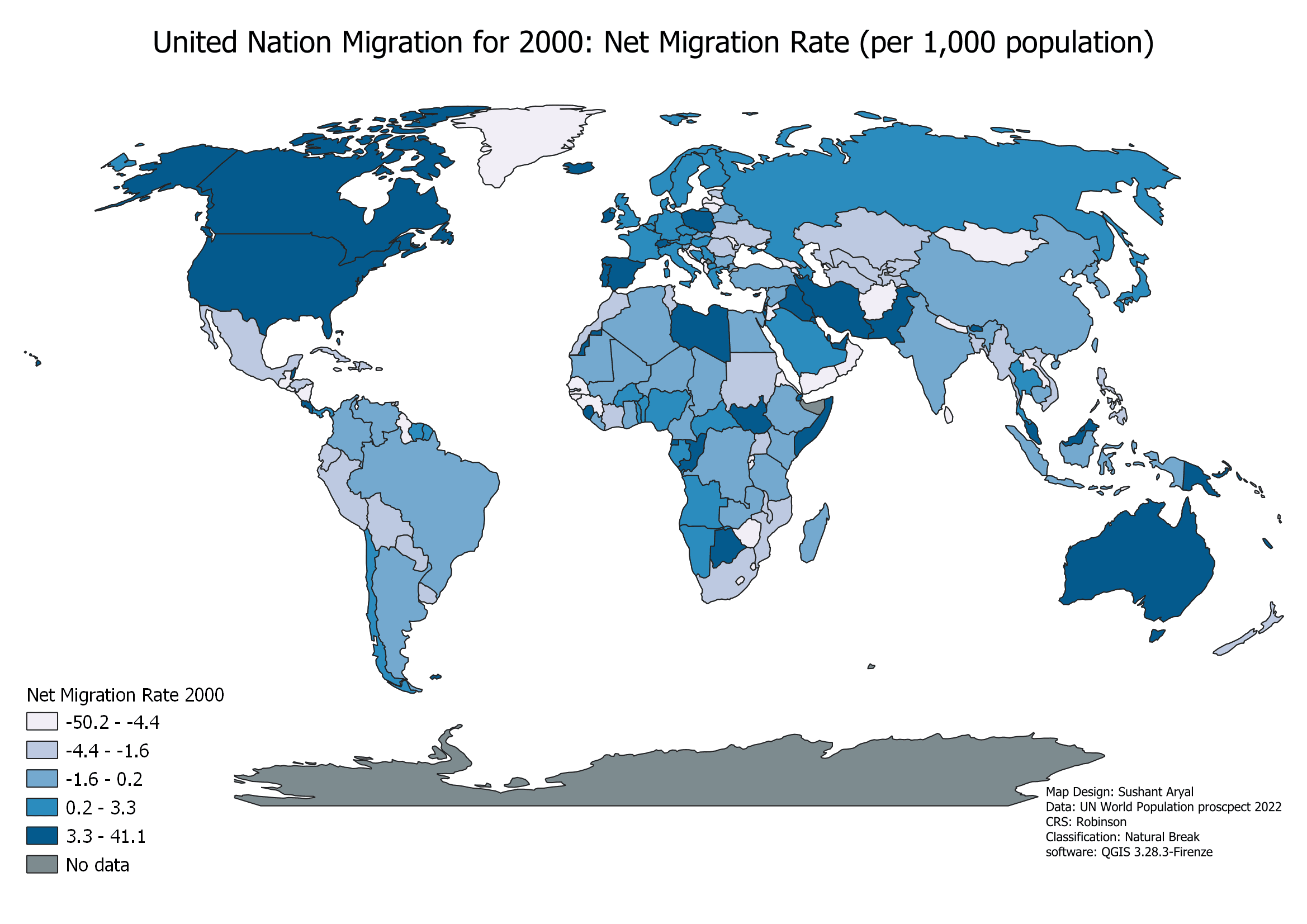
Map Design
Cartography and map design are key for presenting spatial data clearly and accurately. A well-crafted map helps users interpret geographical information and make informed decisions.
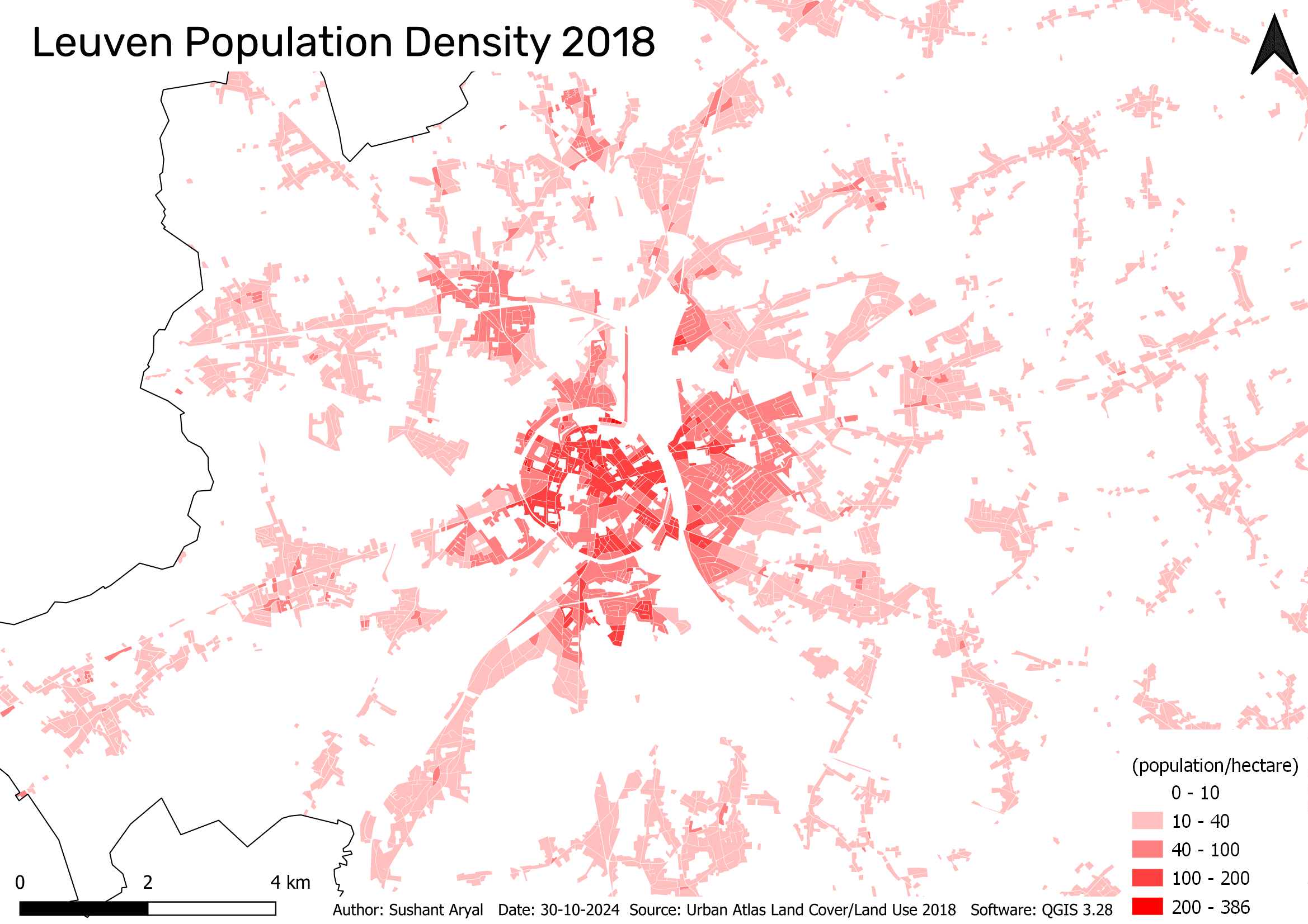
Spatial Urban Data and Geoprocessing
The analysis of European Urban Atlas data reveals patterns of urban accessibility and sprawl, offering insights into land use and population distribution.
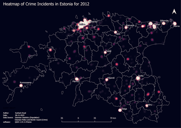
Spatial Data Quality and Data Aggregation
Crime point pattern analysis identifies high-crime areas and their link to population. These insights aid in crime prevention and resource optimization.
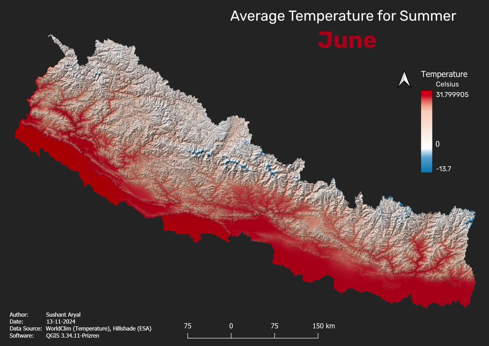
Climate Data
Analyzing climate data reveals patterns and relationships, enhancing understanding of climatic conditions and making insights more accessible.
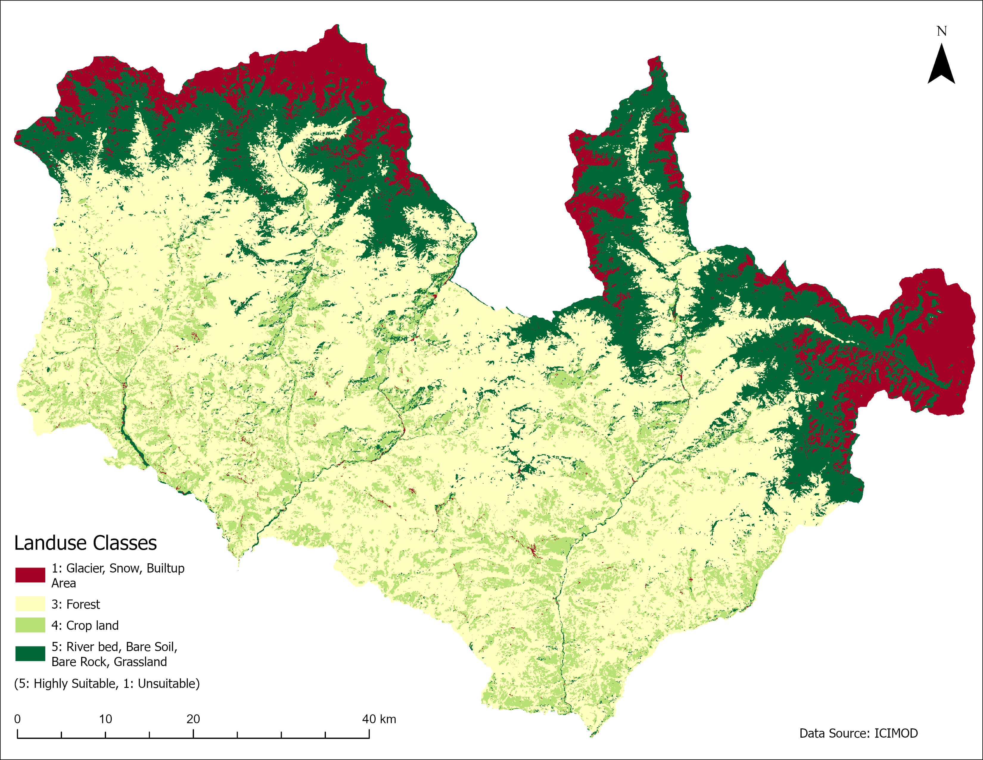
suitability analysis
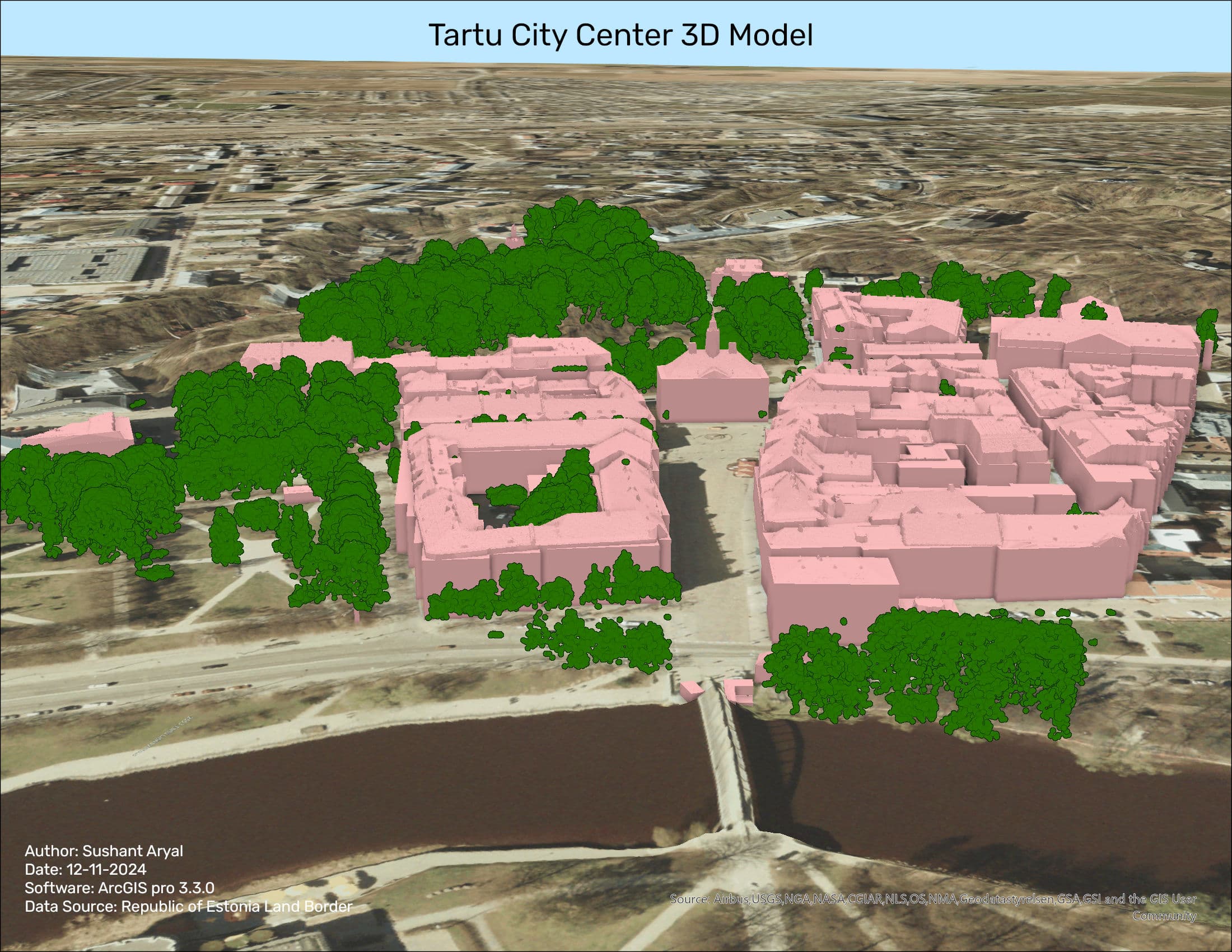
3D Model of Tartu City Center
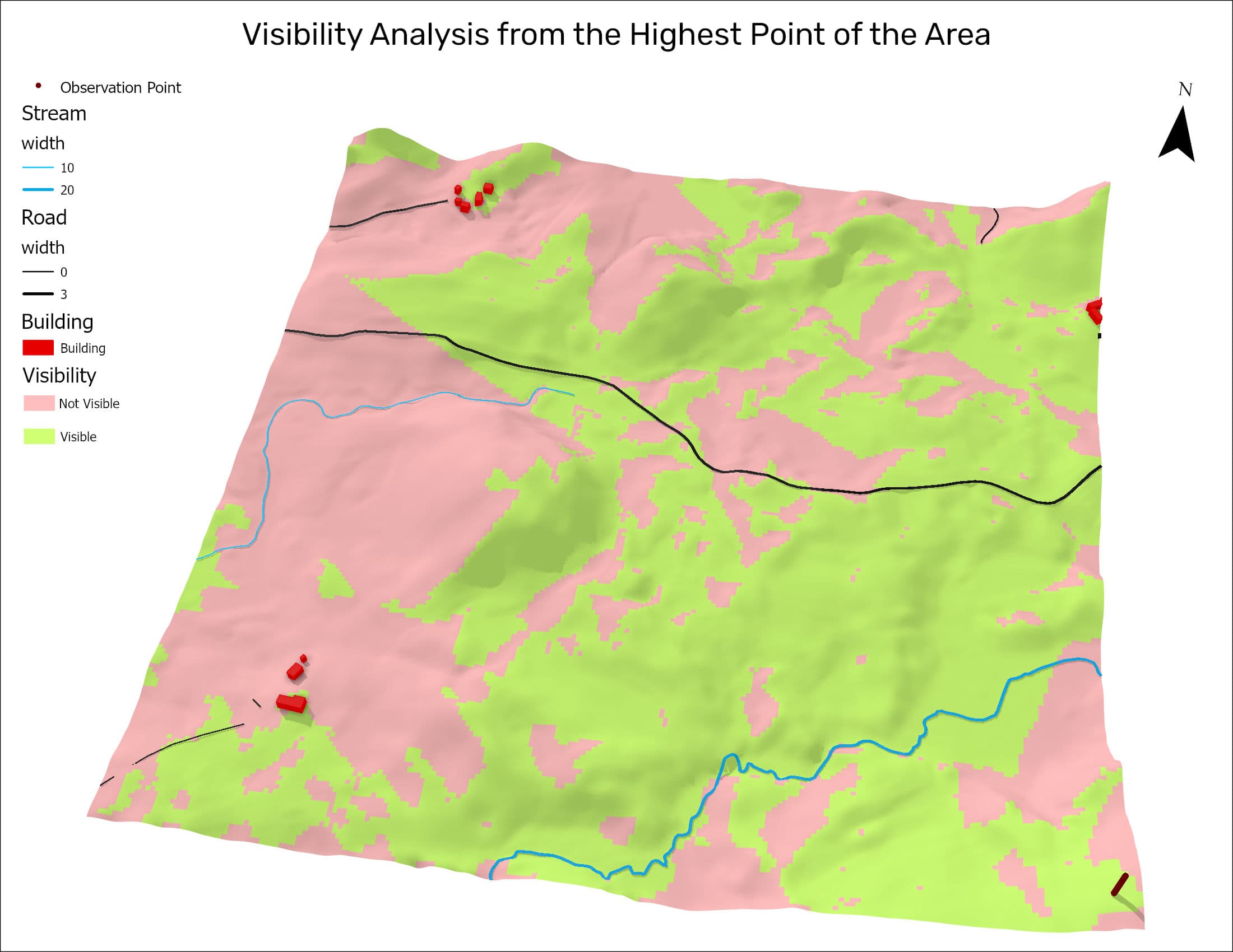
Landscape modelling
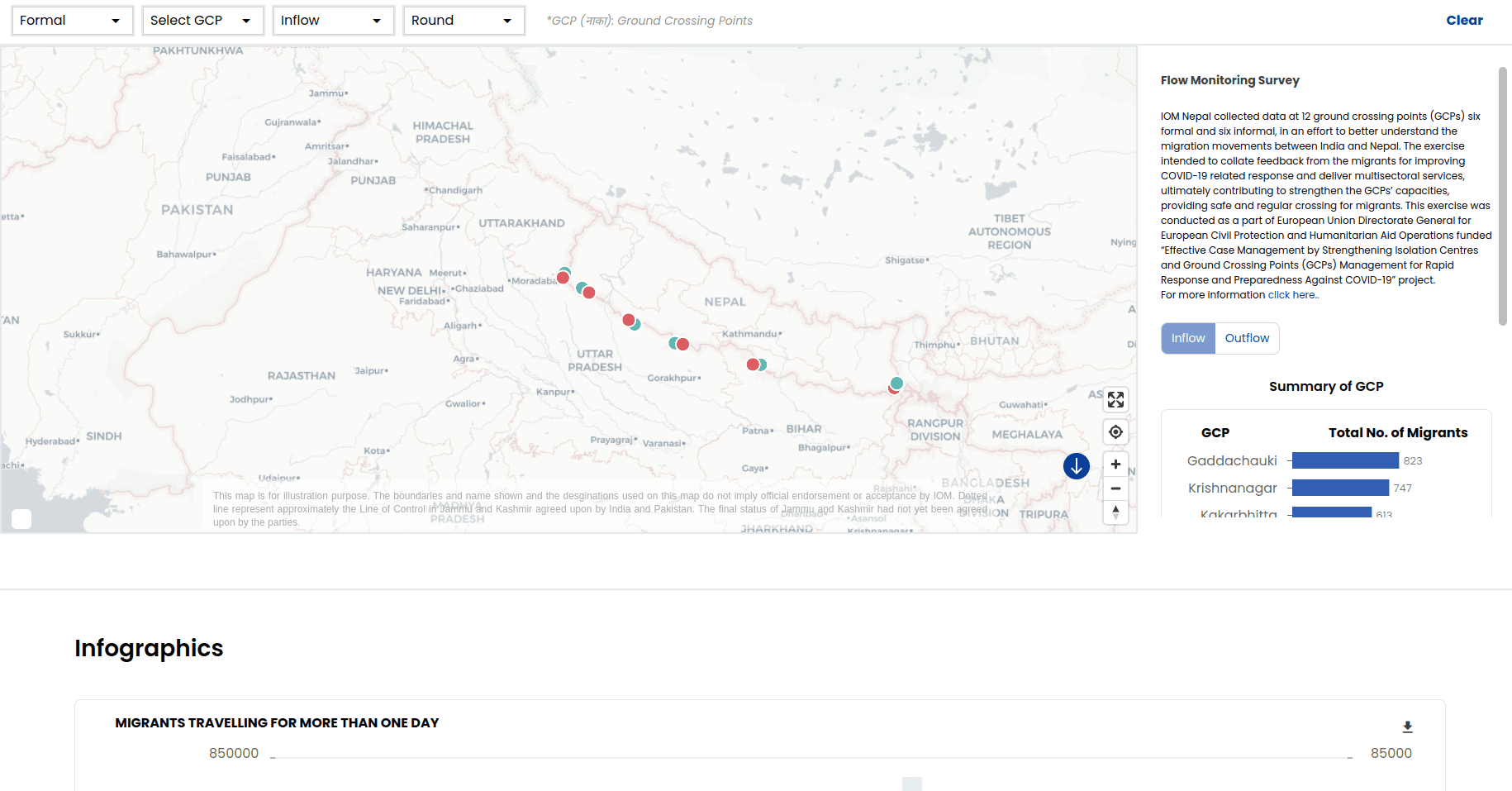
IOM Migration movement visualization between India and Nepal
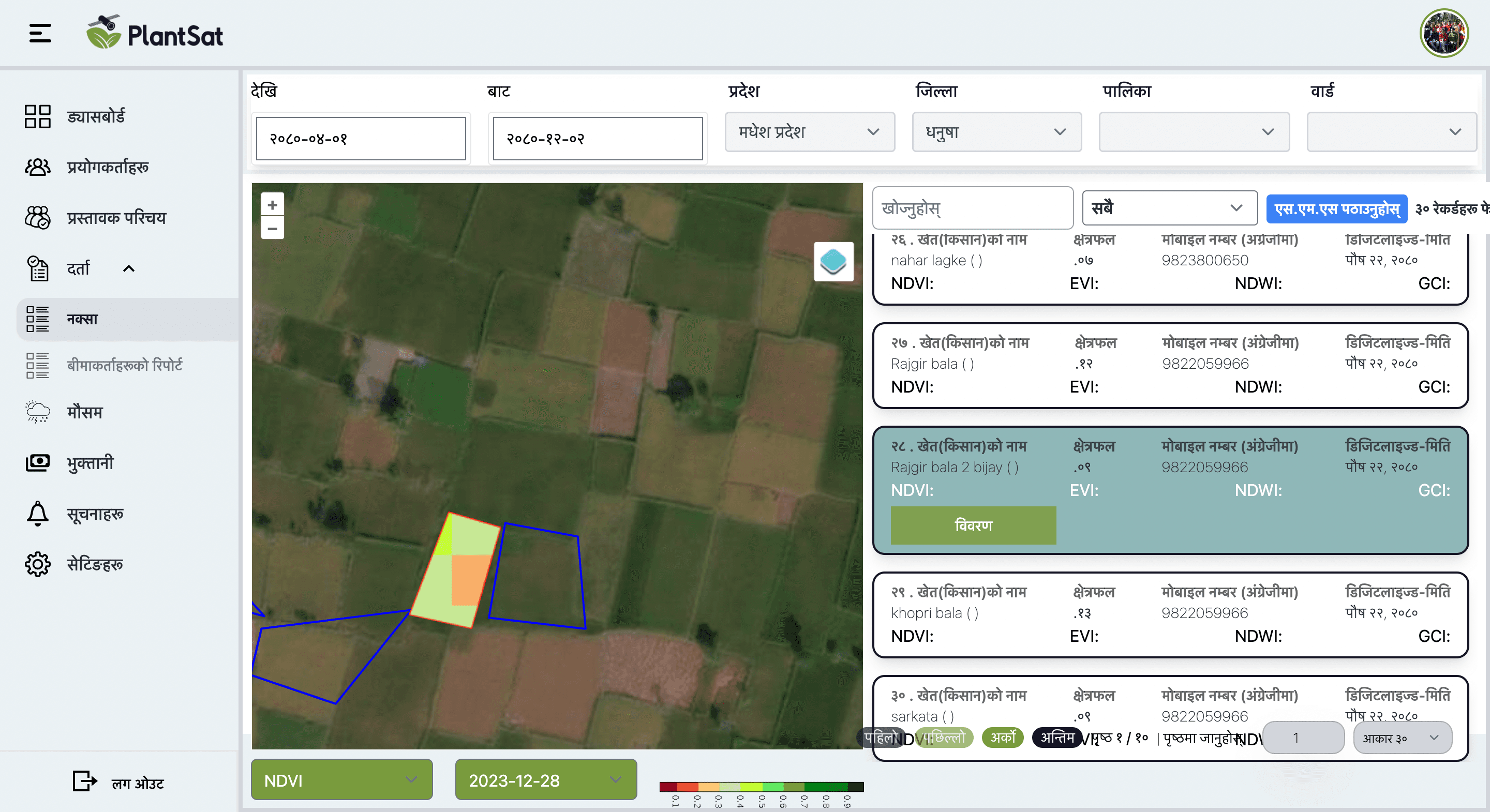
PlantSat
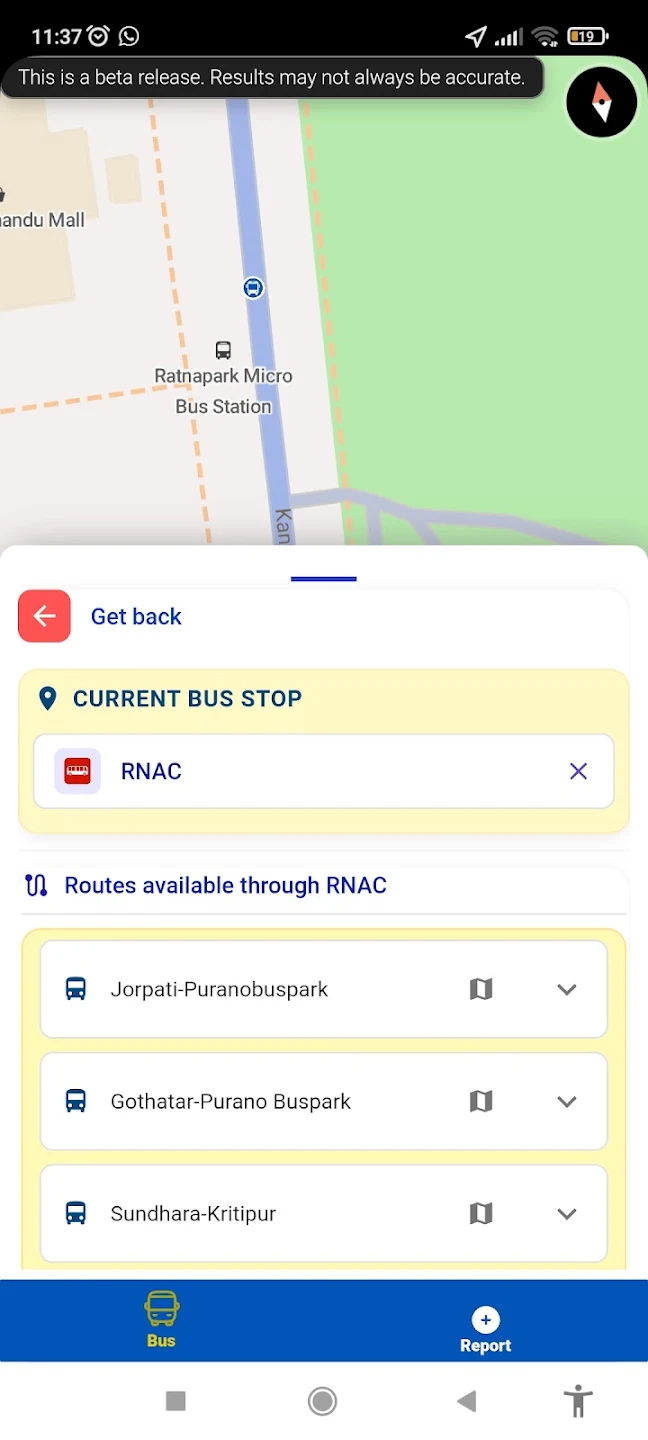
City Yatri
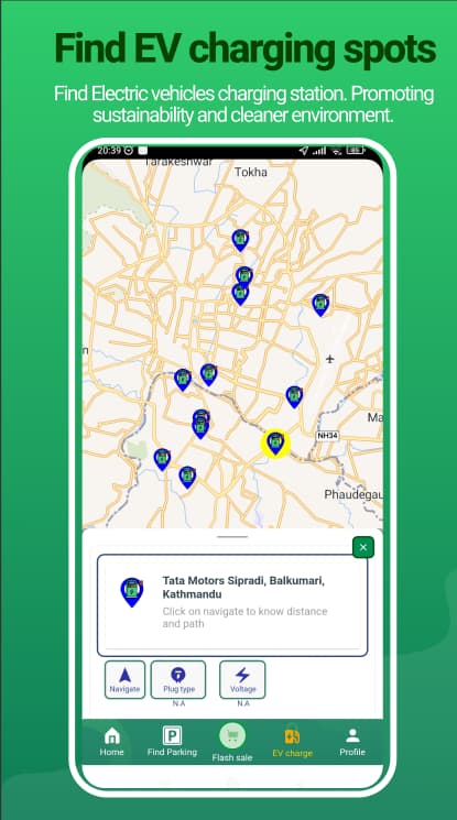
Eco App

DealMap