Land Surface Temperature (LST) and Snow cover visualization for Mountainous District of Nepal
Tools used:
Google Earth Engine
Data used:
MODIS/Terra Land Surface Temperature, MODIS/Terra Snow Cover
Skill Gained:
Data Visualization
Geospatial Analysis
GEE Interactive Tool App Development
Environmental Monitoring
Google Earth Engine (GEE)
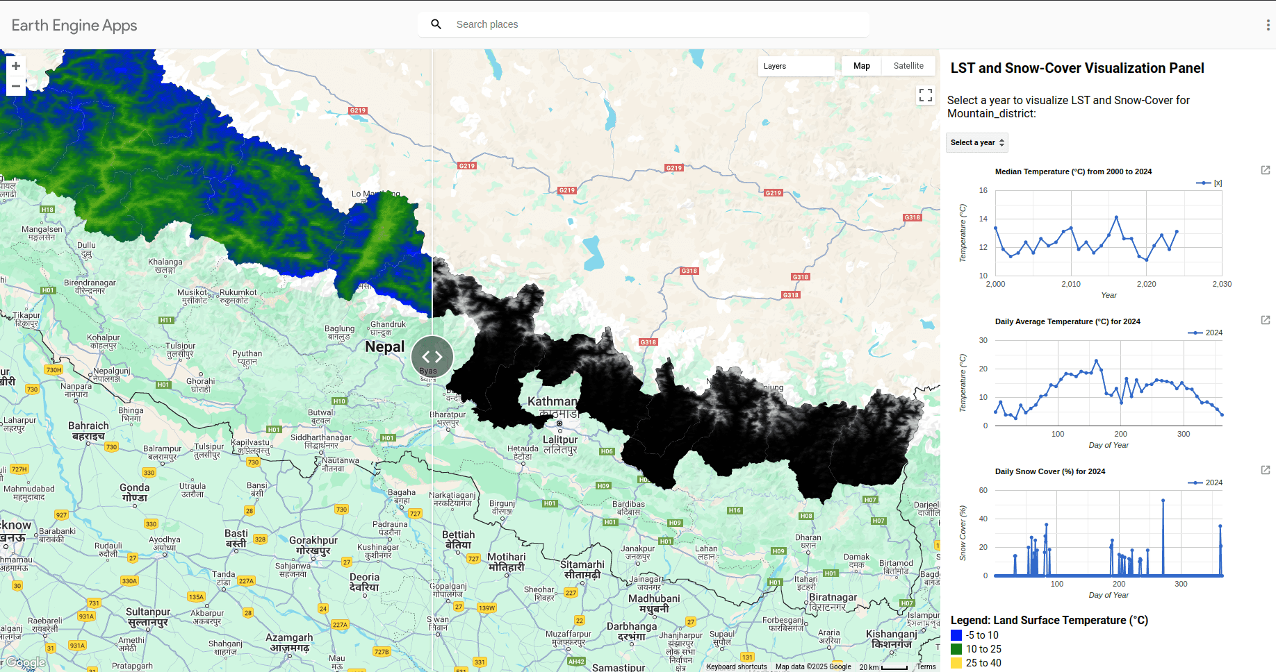
This project aims to analyze and visualize Land Surface Temperature (LST) and snow cover dynamics in the mountainous district of Nepal using satellite imagery and Google Earth Engine (GEE). Nepal, with its diverse topography and unique climatic conditions, is particularly sensitive to variations in LST and snow cover, which are key indicators of climate change and its impacts on the environment.
Explore the project
Open the app in new tabOutcome:
The project is a valuable tool for analyzing climate change impacts by visualizing two decades of temperature trends and snow cover changes. It aids policymakers and planners in managing water resources, predicting natural disasters, and supporting agricultural planning. Researchers can leverage the app to study environmental dynamics, while educators and students can use it as an interactive learning resource for geospatial analysis and environmental monitoring.