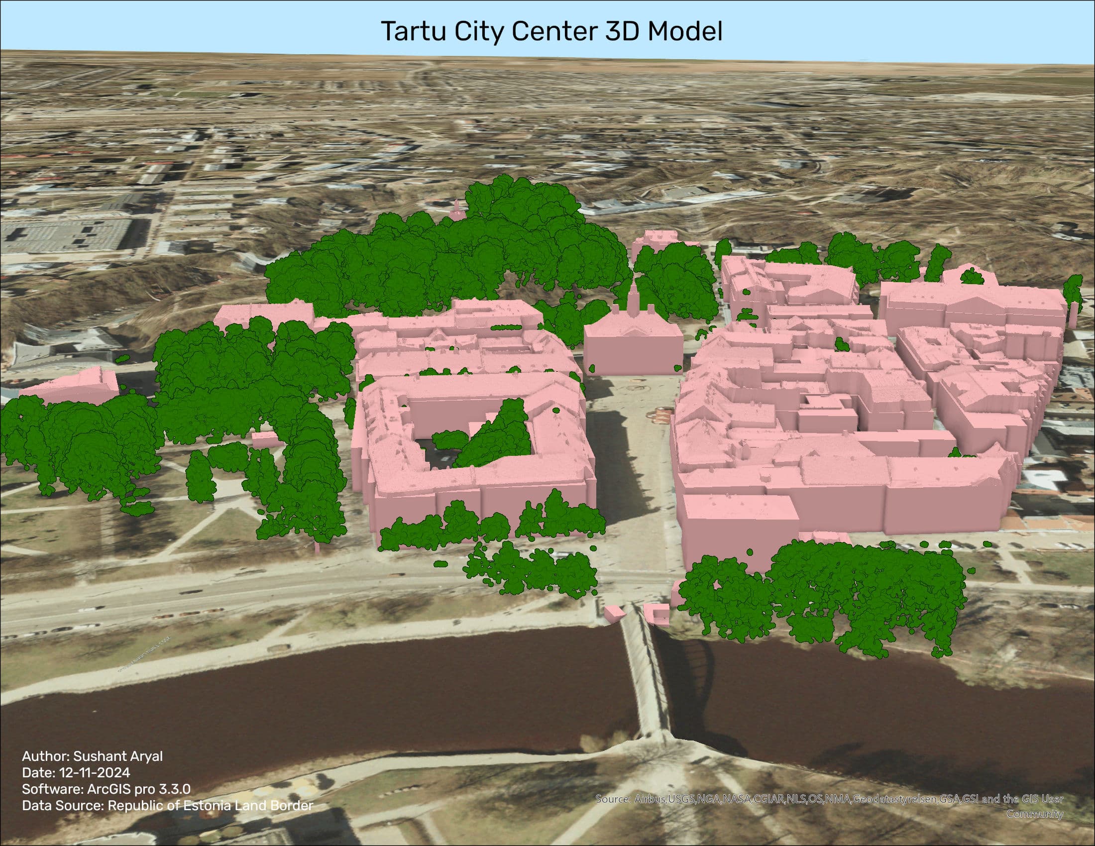
3D Model of Tartu City Center
Tools used:
ArcGIS
Data used:
LiDAR Data, Orthophoto, DSM (Digital Surface Model), DHM (Digital Height Model)
Skill Gained:
LiDAR Data Handling
Creating 3D Features
Building Footprint Creation
Multipatch Creation
Height Attribution
In this lesson, I worked on creating a detailed 3D city model of Tartu using LiDAR elevation data. The goal was to understand the importance of LiDAR data in creating 3D models and products, specifically focusing on creating 3D building models. I explored how to classify LiDAR points, manipulate data, and create 3D building features using various tools in ArcGIS Pro. This task involved handling LiDAR data, creating rasters, regularizing building footprints, adding height attributes to polygons, and transforming them into multipatch 3D models for visualization.
Outcome: